 Maps can turn 535 pages of figures into something you can see and understand in an instant.
Washington state has been working on making it easier for residents to get access to detailed maps full of data. In the old days, state agencies collected scads of facts and figures that few people outside the agency could see. Now, anybody with a computer or smart phone can tap into a lot of that data and see it in map form.
A big reason for that is the Legislature pushed for a set of common standards and one portal where citizens can start looking.
Here’s that link – Washington State Geospatial Portal – along with a few example of what you can find and use:
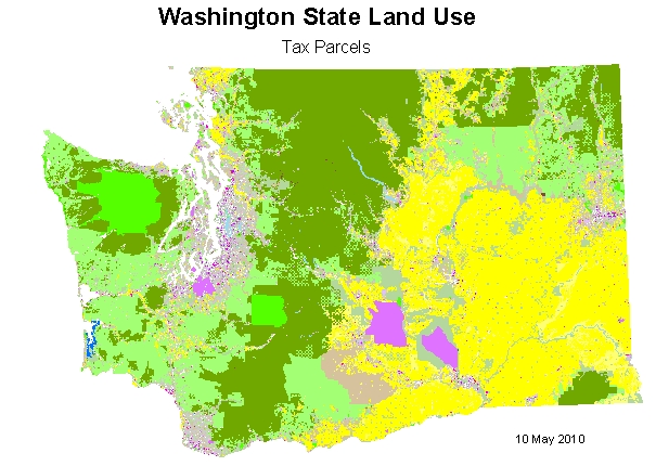
• Land use in Washington state – A good overview of how land is used in Washington state.
• Orthoimagery Viewer – This is a strange name for a great state map.
• Puget Sound LIDAR – A crazy precise way to map topography.
• Washington Interactive Geologic Map – Landslides, tsunamis, volcanoes, earthquakes and anything else you want to check out. This map is like back in the day when you picked which disaster to unleash on Sim City, except there’s no Godzilla option. Yet.
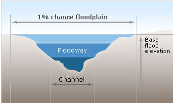
• Flood maps – What are the chances of a 100-year flood where you live?
• Marine Bird Density Atlas – Useful for birdwatchers.
• Hunting and wildlife map – All about hunting and the populations of big game, small game and waterfowl.
• Washington State Parks Maps and Reservations – Camping and hiking are kind of a big deal in our big beautiful state. Pick a park, reserve a date and pitch your tent.
• Transportation project map – This online map is a much better way of finding out what projects are getting built in which parts of Washington state.
• Construction budget map – The same tool as the transportation map, but for state construction projects that don’t involve highways, trains or ferries.